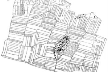
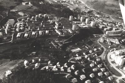
Aero foto podoba in katastrska podoba Arje vasi nam daje dva različna pogleda na kraj. Arja vas je izrazito dolinska in obcestna vas s tipičnimi zavrti. V geografski zbirki »Slovenska naselja« je več podatkov, ki so nastajali vse od leta 1948. S pomočjo geografskega informacijskega sistema so jih preoblikovali tako, da so vsi podatki geokodirani glede na zemljepisno širino in dolžino ter nadmorsko višino.
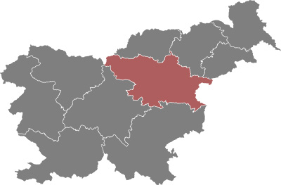
Arja vas leži v osrčju krajevne skupnosti Petrovče s pokrajinsko enoto:
- ravninski del Spodnje Savinjske doline med Savinjo in Ložnico, ki so ga v geološki preteklosti oblikovali prodni nanosi Savinje in njenih pritokov, kjer so najboljša kmetijska zemljišča namenjena kmetijski dejavnosti, v največji meri poljedelstvu in pridelavi industrijskih rastlin, kot sta hmelj in sladkorna pesa.
- s terciarnimi terasami rahlo razgiban skrajni zahodni del Ložniškega gričevja severno od Ložnice, za katerega so značilne pretežno travniške in deloma gozdne površine Arnovski, Ruški in Zaloški gozd.
Savinja na skrajni južni meji krajevne skupnosti Petrovče je največji vodotok, v katerega se zlivajo vsi potoki njenega levega brega, ki tečejo skozi naselja Lava, Ložnica in Pirešica dolvodno v bližini Celja. V spletu različnih krajinskih potez in značilnosti je zarisana podoba krajine naše krajevne skupnosti. Prostorski potencial krajine in njen položaj v razvojni osi urbanega razvoja med Celjem in Žalcem, neposredno vplivata na utrip in kakovost vsakdanjega življenja prebivalcev. Prostorski, gospodarski, socialni, tehnološki, kulturno-civilizacijski, zgodovinsko razvojni in številni drugi vplivi so učinkovali na celostni razvoj kulturne krajine, ki s svojskimi osnovami in poudarjenimi prvinami oblikuje enkratnost in neponovljivost vsakega domačega kraja.
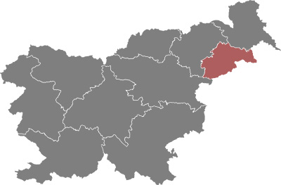
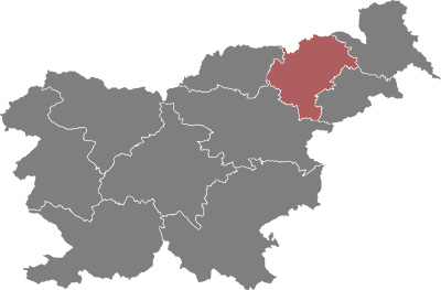
Krajevno skupnost Petrovče sestavlja šest naselij: Petrovče, sedež krajevne skupnosti, ki so se zlile s sosednjo Dobrišo vasjo in Novim Celjem v povezano urbano naselje, Arja vas in Drešinja vas sta naselji v ravninskem delu s tipično obcestno pozidavo, naselja Ruše, Zaloška Gorica ter Mala Pirešica pa se razprostirajo v severnem, rahlo razgibanem delu krajevne skupnosti.
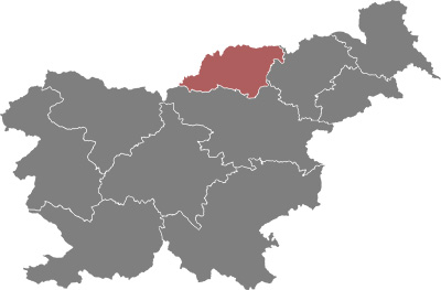
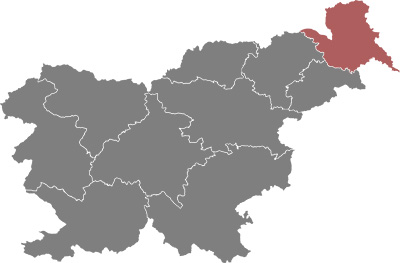
Arja vas ima osrednjo geografsko lego v krajevni skupnosti Petrovče. Arjo vas loči od naselja Petrovče glavna državna cesta G1-5 Celje-Ljubljana. Naselje Arja vas leži v ravninskem delu Savinjske doline na nadmorski višini med 250 in 275m. Leži 6km zahodneje od Celja, 3 km vzhodneje od Žalca in 16km južneje od Velenja.
Arja vas je tipična Savinjska ravninska obcestna vas, z glavno cesto skozi osrednji del vasi ob stanovanjskih hišah in z »zavrtnima« cestama zadaj gospodarskih poslopij. Poselitev je strnjena, obcestna, nastala je kot tipično kmečko naselje prilagojena tehnologiji kmetovanja. V zadnjih desetletjih je poselitev postala vse bolj spalno naselje bližnjih mest Celje, Žalec, Petrovče in Velenje. Ob glavni Velenjski cesti so delavci postavili nove hiše, na severu ob desnem bregu potoka Ložnica pa je nastalo popolnoma novo naselje stanovanjskih hiš. Na terasastem obrobju na severu vasi so raztresene domačije. Tu je zaselek Gmajna, ki ima na terasi pod Rušami novo naselje stanovanjskih hiš.