skok na glavno vebino izjava o dostopnosti

Tabula Peuntigeriana, srednjeveška kopija zemljevida rimskega cesarstva

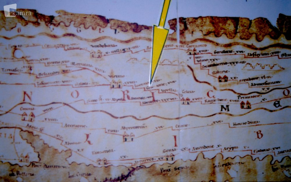
Prvo in hkrati edino omembo Kolacione zasledimo na srednjeveški kopiji zemljevida rimskega cesarstva, na ti. Tabuli Peuntigeriani. Iz Celeje so do krajinskega središča Virunuma proti severu navedene naslednje poštne postaje: Upellae – Colatio – Iuenna. Poleg imen so navedene razdalje v rimskih miljah.

Reprodukcija zemljevida izdelana po fotografiji Viktorja Berka.

Photo

Privacy Overview

This website uses cookies so that we can provide you with the best user experience possible. Cookie information is stored in your browser and performs functions such as recognising you when you return to our website and helping our team to understand which sections of the website you find most interesting and useful.

Filtering options

Search

Content type

Categories
Categories
Categories
Categories
Categories

Region selection


2008 - 2025 © KAMRA, Production: TrueCAD d.o.o.